
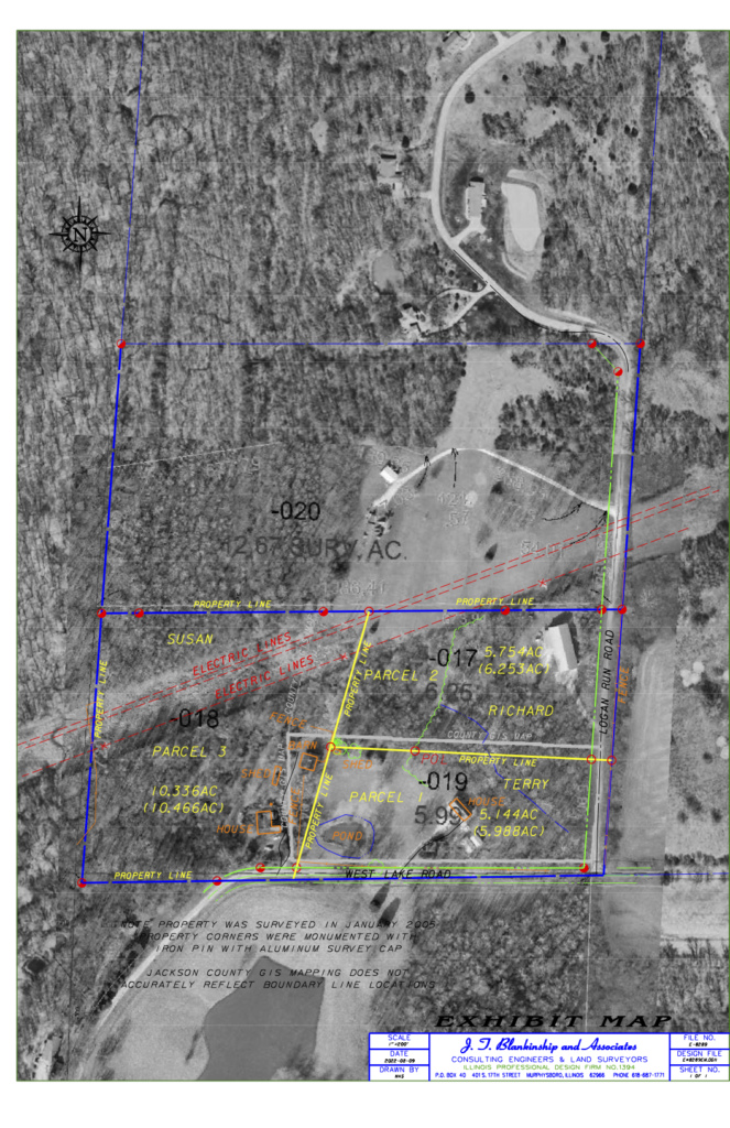
This example shows three parcels of land in Jackson County. Parcel 1 is owned by Terry, Parcel 2 owned by Richard and Parcel 3 owned by an elderly relative of Susan. Originally the 3 parcels were one property which were subdivided in 2005. The landowner at the time requested the barn, shown in parcel 3 and highlighted in orange, to remain with the house, shed and fence as part of the original homestead (parcel 3). The yellow property lines show where the land was divided by a licensed Professional Land Surveyor and submitted to the County Assessor’s Office. The thick grey line is what the county GIS map inaccurately depicts as the property line. As their widest divergence, the distance between the yellow surveyed property line and what the county shows on the GIS map is approximately 120 feet, just wide enough to accommodate a barn.
Susan is selling Parcel 3 on behalf of the ailing relative to pay for their medical expenses and had a buyer committed to purchase until Terry claimed that the barn was actually on his property. Susan lost that sale and is likely to incur additional expenses related to resolving the dispute, as Terry has expressed intention of constructing a fence to encompass the barn based on the location of the County’s GIS parcel lines. As of August 9, 2022 the dispute was yet unresolved.